GPS Automated Travel Diary (GPS-ATD) Enhances Travel Behavior Surveys
Link to pdf here.
| Outcome | Deliver ten vehicular and ten personal GPS-Automated Travel Diary (GPS-ATD) units. |
| Benefit | The GPS-ATD minimizes user burden during household travel surveys, while providing accurate, reliable, and spatially dense traveler behavior information at a significantly reduced cost. This improved traveler behavior information will enhance travel demand modeling, transportation management, and land use planning. |
AHMCT researchers, in conjunction with the Caltrans Division of Transportation System Information, have developed a prototype GPS-Automated Travel Diary (GPS-ATD) to replace traditional paper-and-pencil and computer-assisted approaches for travel surveys. The GPS-ATD minimizes the user burden during longitudinal travel behavior surveys, while providing accurate, reliable, and spatially dense traveler behavior data at a significantly reduced cost.
Why We Are Pursuing This Research
Household travel surveys directly measure traveler behavior at the level of the individual, and provide for a better understanding of the factors that influence personal travel behavior. These data are critical in:

- developing travel demand models and forecasting future demand,
- measuring and understanding trends in population behavior,
- assessing the impact of changes in transportation policy or the transportation system.
Previous surveys used paper-and-pencil diaries to obtain traveler information. This approach has well-known drawbacks, and is not suited for long-term mobility pattern observations. It does not capture detailed route choice information. Moreover, multi-day personal surveys often suffer from survey fatigue and low response rates typical with longer durations. It is common for respondents to under-report or provide incorrect data due to poor memory, misunderstanding instructions, or carelessness. For example, short infrequent trips that occur during the day are most often not reported.
Therefore, a new method is needed for comprehensive, highly automated, and efficient data collection for individual travelers. Many factors can contribute to a driver’s decision for choosing a particular route. A system which can monitor traveler location, time, speed, and current and next task is required. Surveys should be carried on for a long duration while maintaining survey data accuracy and minimizing burden on the respondents. The GPS-ATD addresses these needs, and the resulting system can support the next Caltrans longitudinal travel behavior survey in 2010.
I


What We Are Doing
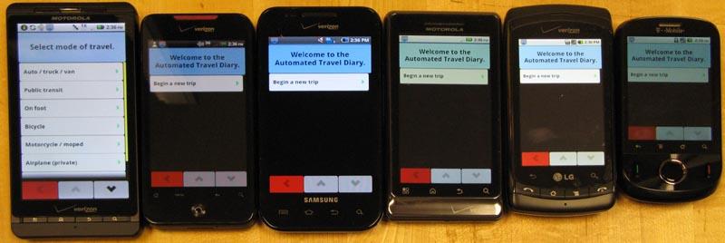
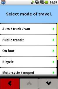
AHMCT researchers have developed both vehicular and personal GPS-ATD systems to support comprehensive traveler behavior studies. The GPS-ATD provides an intuitive user interface to capture the trip activity information (trip purpose, travel mode, etc.), with minimum user input (active, passive and hybrid mode). Each survey participant interacts with their own personal GPS-ATD, and information is automatically coordinated between personal and vehicular GPS-ATD units via wireless handshaking. The system captures and logs data from the GPS receiver, allowing subsequent identification of corridors, route lengths, and regional / inter-regional trips. Because of the advanced and tightly integrated design, the GPS-ATD can provide many additional capabilities beyond the previous methods in travel surveys:
- reduce the user burden by automating data collection and reducing data entry,
- provide activity-time-space relationships,
- minimize under-reported trips,
- capture all modes of transportation and mode connectivity changes,
- record when car doors open which may indicate carpool passenger entering or exiting,
- provide strong support for automated data analysis,
- provide vehicle position during GPS outages using inertial sensors (vehicular GPS-ATD only),
- provide second-by-second detailed vehicle position, speed, acceleration, and emissions information,
- provide wireless synchronization,
- and allow survey duration up to 30 days.
The prototype is shown in Figure 1, with a system block diagram in Figure 2. The primary sensor is the GPS receiver. For the vehicular GPS-ATD, inertial sensing (MEMS gyro and accelerometers) is also provided to fill in the gaps during GPS outages and cold starts. To obtain vehicle sensor information, the GPS-ATD uses wireless communications to the car computer On-Board Diagnostics connector (OBD-II). All wireless communications is provided via ZigBee, a reliable, cost-effective, low-power global standard. All processing is provided via an embedded ARM processor. On-board storage is sufficient to support up to thirty days for a single survey. The system has been carefully designed to maximize battery life, and will operate for a typical full day’s use between charges.
Current Status
AHMCT is currently providing deployment support for field testing of the prototypes by Caltrans. Early field-testing feedback has been incorporated into the system design. The prototype was designed to be mass produced and deployable for future full-scale household survey. The improved surveys will provide decision makers with current, accurate and reliable traveler behavior data at a significantly reduced cost. In addition, the GPS-ATD will minimize user burden and provide activity-time-space relationships.
For Additional Information
| Mohammad Assadi Caltrans Project Manager |
mohammad_assadi@dot.ca.gov | (916) 654-1134 |
| Ty A. Lasky Principal investigator |
talasky@ucdavis.edu | (530) 752-6366 |
| Bahram Ravani Co-Co-Principal investigator |
bravani@ucdavis.edu | (530) 754-6130 |
| Kin S. Yen Primary contact |
ksyen@ucdavis.edu | (530) 754-7401 |
This document is disseminated in the interest of information exchange. The contents do not necessarily reflect the official views or policies of the AHMCT Research Center, the University of California, the State of California, or the Federal Highway Administration. This document does not constitute a standard, specification, regulation, or imply endorsement of the conclusions or recommendations.
(rev. May 2007)
